
Logan and Albert Conservation Association

KOALAS FACE LOCAL EXTINCTION IN LOGAN!
Yarrabilba and Flagstone housing estates high on koala black spot list reports Sarah Orr, from Quest Newspapers January 2, 2017
Australian Koala Foundation chief executive Deborah Tabart says that new housing estates such as Yarrabilba and Flagstone were high on the koala black spot list. These fears echo and re-inforce the worst fears of the Logan and Albert Conservation Association and local group Logan Community Environment Watch.
Ms Tabart was pushing for a freeze on habitat clearing. She said koalas in Logan were “functionally extinct” meaning the population may never recover.
“I’ve seen committee after committee and the core problems don’t go away because we keep cutting habitat down,” she said.
“The Queensland Government will never impose constraints on the developer because that’s where they get their money.” She said she was not surprised rescue groups reported their “worst season ever” for deaths and injuries.
Habitat loss seems to be increasing daily with the planned $750 million southeast Queensland resort complex to be built by a Chinese property developer in a koala habitat area seeks permission to increase its approved 500-unit project on the site to 1500 units.
The areas of proposed clearing for human settlement continues with the most recent application by MIRVAC at Greenbank East
“A proposal to establish a single area for light industries may be favourably considered in the Maclean area ” (Beaudesert Shire Council Strategic Plan 1996)
Pre 1996 North Maclean was zoned rural residential – industrial use was not compatible in this area
1996 Beaudesert shire council changed the zoning of an area at North Maclean to industry on their strategic plan. There was never any community consultation about the suitability of industry in an existing rural residential area.
July 2005 SEQRP released identifying Mt Lindesay North Beaudesert Area (Mt Lindesay North Beaudesert Area) for further investigation
October 2005 Office of Urban Management OUM (State Government) Mt Lindesay North Beaudesert Investigation for South-East Queensland Regional Plan ( SEQRP Amendment 1). North Maclean Enterprise Precinct (industrial area) extended from the Mt Lindesay Highway to the Greenbank interstate railway line.
Jan-March 2006 A community group north Beaudesert Shire Action Group NBSAG surveyed almost 1000 people - 89% opposed industry at North Maclean.
North Maclean Enterprise Precinct was added to the South-East Queensland Regional Plan (Amendment 2006).
March 2007 Beaudesert Shire Council ordinary meeting moved –
“there is no need or justification for the North Maclean Enterprise Precinct …industrial land can be met in other developments across the shire”
May 2007 Beaudesert shire council requested the OUM remove the North Maclean industrial area –
“it is constrained by powerlines, flooding and environmental considerations, plus the need for buffering to nearby rural residential areas …North Maclean is not required…the area should be removed from the SEQRP”
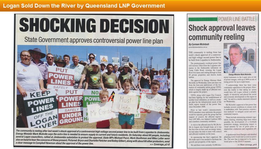
Pre-election promises of the Campbell Newman led LNP government have been broken and the local members must also feel our disappointment. A platform based on the four pillars of economy, construction, tourism and agriculture leaves both natural and built environment out of the equation.
Click on image to read article.
Disinformation is also challenging to deal with - especially when government changes the rules to suit its 'development at any cost' agenda - cost being only dollars for construction. Follow detailed history at VETO's website for analysis of issues an alternatives. Queensland Minister McArdle's approval of the second Loganlea to Jimboomba 110kV powerline allows Energex to continue to "Gold Plate" their network with more "poles & wires" when other alternatives are available.
 Greater Flagstone - what is your vision?
An area criss-crossed by roads - all needing to be upgraded and with extra lanes?
An area where increased human settlement of affordable housing - constructed before adequate wildlife and biodiversity studies are completed by impartial consultants?
An area already being cleared without adequate erosion and sediment controls in place
An area not contained within one connected geographical space
An area where the concept of identified growth areas is include within the UDA Urban Development Area [ renamed in last SEQRP from INVESTIGATION AREAS to identified growth areas - a misleading use of language and terminolgy for those new to the area and SEQRP documents]
OR DO YOU WANT AN AREA WHICH DEMONSTRATES THE ON GROUND PRINCIPLES OF
ECOLOGICAL SUSTAINABLE DEVELOPMENT?
Read LACA president's presentation notes from Greenbank submission writing workshop Tuesday 19 April 2011.
 Greater_Flagstone_submission_Workshop_19_04_11.pdf Bytes 01/01/1970, 10:00
View presentation  greater_flagstone_april_2011_edo_workshop.pdf
Although many of us want to have better roads all the road changes will mean more tree clearing - meaning loss of habitat and other services provided by trees.
Have you seen Mt Lindesay Highway recently [ at least 3 koalas were seen in area by the wildlife spotters] ? This is an example of what is to come .
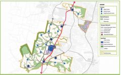
Following roads are listed in ULDA documents •Teviot Rd (Middle Rd - Kilmoylar Rd •Homestead Dr ( to Teviot Rd) •Cusack lane ( Teviot Rd - Johanna St) •Johanna ( Cusack Lane - Mt Lindesay Hway •Camp Cable Rd ( Mt Lindesay - Waterford-Tamborine Rd) •Crowson Lane ( Greenbank - Mt Lindesay Highway) •Greenbank Rd ( Crowson Lane – Mt Lindesay Hway) •Stoney Camp Rd ( Teviot Rd – Mt Lindesay Highway) •Mt Lindesay Highway (Johanna St to Logan Motorway) •Chambers flat Rd ( Chambers Flat to Waterford-Tamborine Rd) •Goodna Rd – Springfield Greeenbank Arterial – Middle Rd.
If you click on image above, a new page will open for the ULDA Urban Land Development Authority Greater Flagstone UDA Proposed Development Scheme documents.
There are many background reports [30 as of today 26 April]. This page has links to 33 guidelines,posters or strategies today.
COME ALONG TO THE JIMBOOMBA SUBMISSION WRITING WORKSHOP WITH EDO AND LACA
Wednesday 27 April at Caddies 7-9 pm
33 South St Jimboomba
HARDCOPIES OF ALL DOCUMENTS SHOULD BE AVAILABLE AT JIMBOOMBA GREENBANK and LOGAN VILLAGE LIBRARIES for reading on site
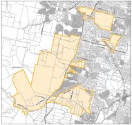 The major land mass for Greater Flagstone is west of the interstate railway line. Click on image to open ULDA map file.
Many people do not asociate Greenbank and North Maclean with an urban footprint tagged with Flagstone. Until now Flagstone has not even been a suburb of Logan but part of the suburb of Jimboomba. The Flagstone estate has been an area with small acreage development for many years with both primary and secondary schools within the area.
The use of creeks and rivers as the boundary line - cutting some proprties into two - is cause for concern since there are policies for protecting riparian corridors - but policies without teeth in legislation offer no protection.
To have such disparate areas proposed as a model city for development does not match my vision - or community vision expressed at WOSPP. Teviot Road and Cusack Lane are major access roads used by present population. High density development west of rail line will mean multiple crossing across the rail line to access Teviot Road.
There are many documents on ULDA website to read to make an informed submission. EDO workshops will be held to help you with submissions.
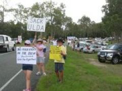 Draft 'blueprints' for South East Queensland's three new master-planned communities released
Deputy Premier and Minister for Local Government Paul Lucas was joined, on Friday 1 April 2011, by Ipswich Mayor Paul Pisasale and local MPs Rachel Nolan and Wayne Wendt for the unprecedented simultaneous release of the proposed master plans for Yarrabilba, Ripley Valley and Greater Flagstone Urban Development Areas (UDAs).
"This is the first time a community building program of this size and scale has been undertaken in Australia and it coincides with the one year anniversary of our government's Growth Management Summit," Mr Lucas said.
His statement that this marks the start of delivering the necessary planning framework to progress development of these three key areas as model communities in not credible. The media release was reported here
Since 2005 LACA has been advocating and lobbying for detailed background environmental studies to be both carried out and provided to the community as part of supposed openness and integrety of government. Access to studies done on behalf of Beaudesert has ben denied by Scenic Rimm Regional Council, Logan City Council [we now has 3 environment reports] and ULDA.
How can you have a model community - one that is based on ecological sustainable development principles when the existing wildlife with its essential habitat is not well mapped. This black hole of essential data must be filled before genuinely ecological sustainable development can b planned. Enen where we have an existing human settlement that is targeted for urban renewal or redevelopment.
 In 2004 the Mount Lindesay North Beaudesert Study Area (MLNBSA) was identified for investigation for increased human settlement. Logan and Albert Conservation members have been actively involved in asking to access for background studies and documents that may show support local council support for development in this area and also the onground biodiversity studies to show the existance of wildlife and their essential habitat.
Before 2004 we believe there was no study done to suggest Mount Lindesay North Beaudesert Study Area be included in investigation for increased human settlement. Yarrabilba a Delfin project was in discussion with Beaudesert Shire Council
Despite there being a RTI - Right to Information process LACA has not yet obtained copies of studies produced for Beaudesert Council at $4000000 cost to ratepayers. In fact SRRC and Logan Council both quibble about ownership of documents - and commercial in confidence.
Scenic Rim Council even in 2010 voted to NOT DISCLOSE TO LACA the NAMES of the documents.
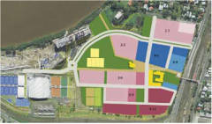 Yeerongpilly transit oriented development may provide some useful information for the Greater Flagstone area residents - may being the operative word. The Yeerongpilly TOD Concept Plan of Development supporting report outlines how the Yeerongpilly TOD may be developed over the next five to ten years and sets out strategies for various aspects such as transport, community development and environmental sustainability.
See the concept plan here. HAVE YOUR SAY.
The difference between Yeerongpilly and Greater Flagstone is that the former is to be built in an area which has already been developed - while Greater Flagstone is termed greenfield which means that there is currently no major development there. In order to 'manage growth' government prefers large landholders. Since these large landholders have been landbanking for future development - and financial gain.
Or you can search the archives here